This
concept is not only important in geographical studies but also in fostering a
stronger sense of national identity. By understanding Indonesia as a Maritime
Continent, people are encouraged to move beyond the perspective that sees the
sea as a divider between islands. Instead, the sea should be viewed as a
connecting space that unites the entire archipelago.
This
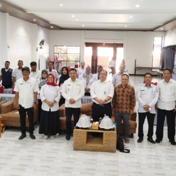
perspective was presented by Dr. Rijal Idrus, Chair of the Indonesian Maritime
Continent Institute (IBMI) at The Habibie Center, during an orientation session
for students participating in Hasanuddin University’s Climate Village Program
(ProKlim) community service initiative, supported by Indonesia’s Ministry of
Environment and the Hans Seidel Foundation.
MARITIMEPOSTS.COM– Many
people still regard the sea as a barrier separating islands. For Indonesia,
however, the sea is precisely the element that binds the archipelago together.
According to Dr. Rijal Idrus, Head of the Climate
Change Study Center at Hasanuddin University, this perspective forms a crucial
foundation for understanding Indonesia as a Maritime Continent of Indonesia—a
concept that views land, sea, and airspace as an inseparable geographical
unity.
During his presentation on Indonesia’s geography,
participants were invited to reconsider the map of the archipelago from a
different perspective.
Rijal posed a simple question: Makassar lies between
Sulawesi and Kalimantan. What function does the sea between these two islands
serve?
Some participants responded that the sea functions as
a divider. Yet this answer became an opportunity to challenge a common
misconception.
“The sea is not a separator; it is a unifier,” Rijal
Idrus emphasized.
This view aligns closely with the spirit of Indonesian
nationalism expressed every week through the national anthem, Indonesia
Raya.
In the anthem’s opening verse is a phrase familiar to
all Indonesians: “Indonesia tanah airku” (“Indonesia,
my homeland”).
According to Rijal, the phrase tanah
air carries profound meaning. Land (tanah) and water (air)
are not separate entities but together form the identity of the Indonesian
nation.
When
looking at a map of Indonesia, the green areas representing land and the blue
areas representing the sea should not be understood as distinct spaces. Rather,
they are components of a single living environment.
If the sea is perceived as a separator, such a
perspective contradicts the national vision embodied in the Unitary
State of the Republic of Indonesia (NKRI).
“Every time we sing Indonesia
Raya, we say ‘Indonesia tanah airku.’ From the very beginning, the
nation’s identity has been built upon the unity of land and sea,” he explained.
This perspective is especially important because
Indonesia is not merely a country that happens to have many islands. It is an
archipelagic nation whose very existence is defined by the sea.
The sea connects thousands of islands, serving as a
pathway for human mobility, trade, cultural exchange, and the social and
economic cohesion of the archipelago.
Therefore, understanding the NKRI requires more than
simply looking at the country’s land territory.
“The letter ‘K’ in NKRI
stands for Kesatuan (Unity), which means that all elements of
Indonesia’s territory constitute a single, integrated entity. There is no
separation between islands, seas, and airspace,” he said.
It is from this perspective that the concept of the Maritime
Continent of Indonesia emerges.
Indonesia possesses characteristics similar to a
continent because of its vast and integrated geographical system that
encompasses land, waters, and the atmosphere above them. Unlike most
continents, however, which are dominated by landmass, Indonesia’s defining
feature is its maritime character.
For this reason, the term Maritime
Continent of Indonesia is used to describe a unified
territory consisting of land, water, and air within the framework of the
Republic of Indonesia.
“The Maritime Continent
of Indonesia is nothing other than the unity of the nation’s land, water, and
airspace,” Rijal explained.
This concept is significant not only in geography but
also in strengthening national consciousness.
By understanding Indonesia as a maritime continent,
people are encouraged to abandon the notion that the sea separates islands.
Instead, the sea should be recognized as a connective space that unifies the
entire archipelago.
Amid challenges related to development, climate
change, and natural resource management, the concept of the Maritime Continent
of Indonesia is becoming increasingly relevant.
Goal 13 of the 17 Sustainable Development Goals (SDGs)
focuses on climate action, which means taking urgent measures to combat climate
change and its impacts.
This goal is referred to as Climate Action: take
urgent action to combat climate change and its impacts. There is not a single
country in the world that is unaffected by climate change. Greenhouse gas
emissions continue to rise, and global warming is causing long-term changes to
the Earth’s climate system.
Recognizing that land, Rijal said, the sea, and
atmosphere form an interconnected system can help the nation design development
strategies that are more integrated, sustainable, and aligned with Indonesia’s
identity as the world’s largest archipelagic state.
Ultimately, when Indonesians refer to their tanah
air—their homeland—they are not speaking only of the land beneath
their feet. They are also referring to the seas that connect the islands and
the skies that shelter the entire archipelago.
That is the essence of Indonesia as a Maritime
Continent: a unified entity that cannot be divided by
geographical boundaries between islands, because the sea itself serves as the
nation’s principal bond.
****
Dr. Rijal Idrus, Chair of the Indonesian Maritime Continent
Institute (IBMI) at The Habibie Center
This
article was published in Maritimeposts on 3.June.2026